Table of Contents
- What Is the Pekoe Trail Sri Lanka?
- Pekoe Trail Stage 1: Hanthana to Galaha
- Pekoe Trail Stage 2: Galaha to Loolkandura
- Pekoe Trail Stage 3: Loolkandura to Tawalantenne
- Pekoe Trail Stage 4: Tawalantenne to Pundalu Oya
- Pekoe Trail Stage 5: Pundalu Oya to Watagoda
- Pekoe Trail Stage 6: Watagoda to Kotagala
- Pekoe Trail Stage 7: Kotagala to Norwood
- Tips for Walking the Pekoe Trail Stages
- Responsible Trekking on the Pekoe Trail
- Frequently Asked Questions
1. What Is the Pekoe Trail Sri Lanka?
The Pekoe Trail Sri Lanka is the island’s first long-distance walking trail. It stretches over 300 kilometres across the central highlands through 22 interconnected stages, running from the Ceylon Tea Museum in Hanthana near Kandy all the way to the Pedro Tea Estate in Nuwara Eliya. The trail was fully opened in 2024 and was designed to connect the historic tea-growing regions of the hill country while supporting the local communities that have shaped this landscape for generations.
The name comes from the tea leaf itself. “Pekoe” refers to the tender young buds and leaves that are carefully hand-plucked from tea plants, and Orange Pekoe is one of the most recognised grades of Ceylon tea. Walking the Pekoe Trail Sri Lanka means walking through the very land where that tea was born, grown, and carried around the world.
This guide covers the first seven Pekoe Trail stages in detail. These stages run through the Kandy and Hatton regions, passing through ancient tea estates, colonial roads, mountain passes, reservoir views, and some of the most historically significant landscapes on the island. Whether you plan to walk all seven stages back to back or explore them one at a time, this guide gives you everything you need to know before you set out.

2. Pekoe Trail Stage 1: Hanthana to Galaha
Distance: 12.84 km Duration: 8 hours Difficulty: Easy Elevation Gain: 537 m Elevation Loss: 470 m Maximum Elevation: 1,067 m Region: Kandy People Interactions: High
This first Pekoe Trail stage sets the tone for everything the trail has to offer. It begins at the Ceylon Tea Museum in Hanthana, housed inside a beautifully restored colonial-era tea factory on the historic Hanthana Estate, and finishes at the Galaha Post Office. The route carries you through shaded plantation roads, sweeping mountain ridges, and quiet village life. It is a gentle and welcoming introduction to the Pekoe Trail Sri Lanka, well-suited to most fitness levels.
Through Hanthana Tea Estate
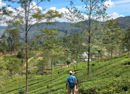
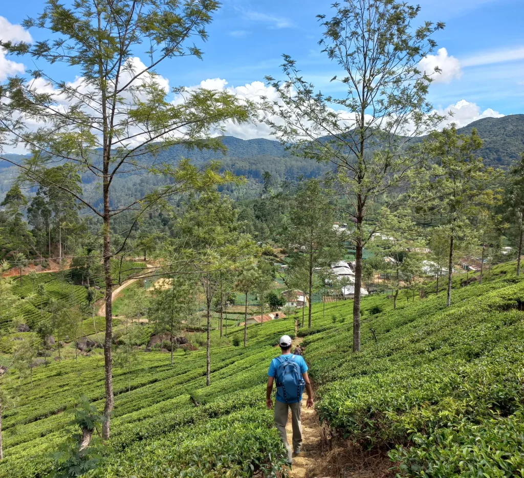
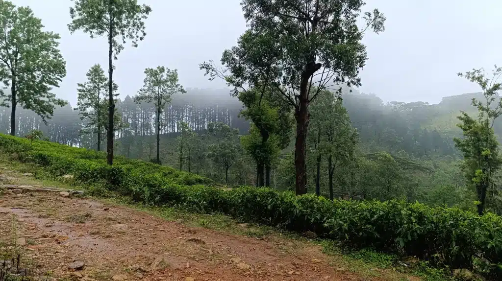
From the museum, this Pekoe Trail stage climbs gently through Hanthana Tea Estate, one of the oldest and most expansive plantations in the country. Tall trees line the path and views of Kandy city open up behind you as you climb. On a clear morning, you can see the entire city laid out below, framed by the seven Hanthana peaks.
At around 1.4 kilometres, a small local shop offers an early stop for a chilled King Coconut or fresh fruit. The surface changes from concrete to gravel as you continue, and simple cabanas line the path. At 5.2 kilometres, a short side trail branches toward a quiet stupa used for meditation.
The Summit and the Views
This Pekoe Trail stage reaches its highest point at 5.7 kilometres, sitting at 1,008 metres above sea level. On a clear day, you can see the glittering expanse of Victoria Reservoir and the jagged outline of the Knuckles Mountain Range, a UNESCO World Heritage landscape that defines the character of Sri Lanka’s central highlands.
Descent Through Villages and Forest
The walk down winds through quiet villages. Film enthusiasts will appreciate that parts of Indiana Jones and the Temple of Doom were shot in this area. At 10.8 kilometres, the trail crosses a bridge over a river before entering a cool pine forest. The Pekoe Trail stage finishes at the Galaha Post Office, just 900 metres further along.
Highlights
- Start at the historic Ceylon Tea Museum inside a restored colonial factory
- Walk through Hanthana Tea Estate, one of the oldest plantations in Sri Lanka
- Panoramic views of Kandy city and the seven Hanthana peaks
- Indiana Jones and the Temple of Doom filming location
- Views of Victoria Reservoir and the UNESCO-listed Knuckles Mountain Range
- Pine forests, villages, and a scenic river crossing
3. Pekoe Trail Stage 2: Galaha to Loolkandura
Distance: 14.7 km Duration: 8 hours Difficulty: Difficult Elevation Gain: 853 m Elevation Loss: 510 m Maximum Elevation: 1,402 m Region: Kandy People Interactions: High
This Pekoe Trail stage is the most historically significant of the first seven. It takes you from the Galaha Post Office to Loolkandura, the very birthplace of Sri Lanka’s tea industry. The stage splits naturally into two halves: Galaha to Deltota, and Deltota to Loolkandura. It is the most demanding Pekoe Trail stage in the Kandy region, but the historical and scenic rewards are unlike anything else on the route.
Galaha to Deltota
This Pekoe Trail stage begins at the Galaha Post Office and moves through the scenic Deltota Estate. At 1.3 kilometres, a signboard marks a right turn onto the estate path. The gradient picks up steadily, and looking back gives you wide views of the Hanthana Estate and surrounding peaks. At 4.6 kilometres, a bridge to your left marks an important turn. Local residents know this section well and are always happy to help with directions.
Deltota is a lively hill country town with a market worth exploring properly. Stalls sell fresh fruit and vegetables, colourful murals decorate the walls, and it is a good place to refuel before the more demanding second half of this Pekoe Trail stage.
Deltota to Loolkandura
Leaving Deltota, the trail climbs steeply and the surface changes from tarmac to gravel. For the next 2.5 kilometres, the path moves through an old pine forest shaded by towering trees. This section of the Pekoe Trail Sri Lanka is known for leeches, especially after rain, so check your legs regularly. At 8.3 kilometres, a tea estate road zigzags up the mountain. At 9.7 kilometres, an abandoned village appears alongside a small river crossing, and yellow and red concrete posts keep you on track. By 10.5 kilometres, the path opens onto a wide estate road leading into Loolecondera Estate.
The Birthplace of Ceylon Tea
Loolecondera is where Sri Lanka’s tea industry was born. It was here, in 1867, that James Taylor planted the very first commercial tea crop on the island. A track to the right of this Pekoe Trail stage leads to James Taylor’s original cottage. Field No. 7, the actual first tea field ever planted in Sri Lanka, is still growing today. From the cottage, the trail descends through lush tea bushes and massive rock formations before finishing at a bridge beside a Hindu shrine.
Highlights
- Walk through the picturesque Deltota Estate with sweeping mountain views
- Explore Deltota’s lively hilltop market
- Hike through a towering old pine forest
- Visit James Taylor’s original cottage at Loolecondera Estate
- See Field No. 7, the first tea field ever planted in Sri Lanka
- Dramatic rock formations and high-elevation rainforest near the finish
4. Pekoe Trail Stage 3: Loolkandura to Tawalantenne
Distance: 18.11 km Duration: 10 hours Difficulty: Difficult Elevation Gain: 762 m Elevation Loss: 1,020 m Maximum Elevation: 1,586 m Region: Kandy People Interactions: Low
This is the longest and most ambitious Pekoe Trail stage in the Kandy region. Starting at a small bridge over the Ma Oya on the Loolkandura Estate, this Pekoe Trail stage carries you through ancient tea trails, a forgotten colonial road, a dramatic mountain pass, and a long descent into the Kotmale Valley. The Loolkandura Estate was established by James Taylor, widely regarded as the father of Ceylon tea, and that sense of living history stays with you throughout the day.
The Climb Through Loolkandura Estate
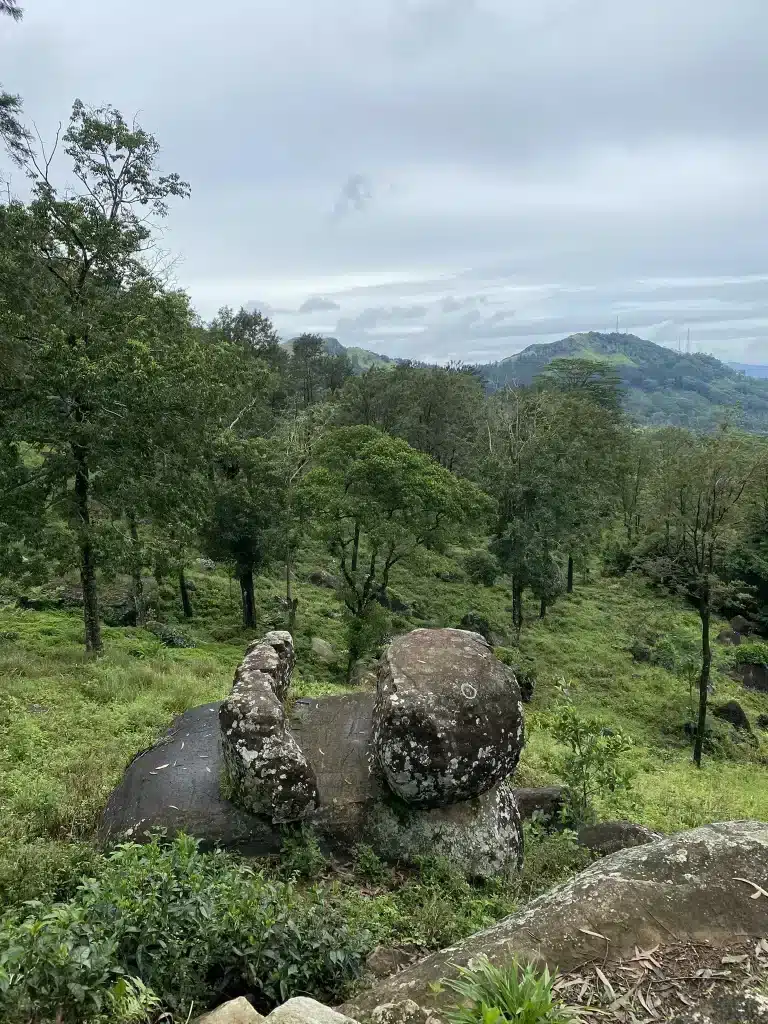
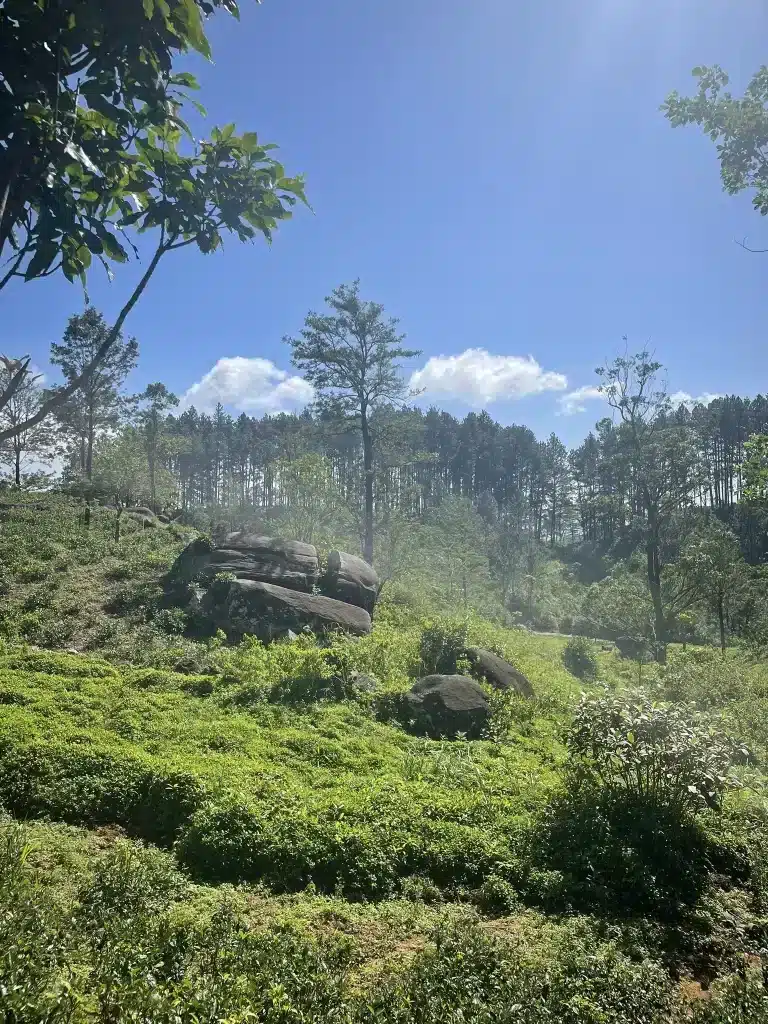
This Pekoe Trail stage begins with a steep climb of 250 metres within the first hour. At 0.3 kilometres, the route leaves the main road and takes a smaller ascending path to the right. A colourful Hindu Kovil and the Loolkandura Estate Bungalow come into view below as you gain height. At 1.1 kilometres, a path drops to a river with beautiful rock pools, which is a worthwhile detour before the real climbing begins. Pine forests and rock formations line the route as the trail grows quieter and more remote with every step.
The Dimbula Road
At around 4 kilometres, this Pekoe Trail stage enters the jungle and steps onto the old Dimbula Road, built more than 150 years ago by British engineers to connect Kandy with the distant tea valleys. The stonework and gradient still speak to the quality of 19th-century construction, even as the forest slowly reclaims the road around it. It is one of the most atmospheric stretches on the entire Pekoe Trail Sri Lanka.
Crossing the Mountain Pass
At 4.7 kilometres, this Pekoe Trail stage crosses the mountain pass and arrives on the Stellenberg Estate. The Kotmale Valley spreads out below, the Rilagala mountain range rises in the distance, and on a clear day, Adam’s Peak is visible on the horizon. The Central Highlands of Sri Lanka hold UNESCO World Heritage status for their outstanding natural beauty and biodiversity, and standing at this pass, that recognition feels completely deserved.
The next 4.5 kilometres follow the relatively flat estate roads of Stellenberg heading south. Unlike the shaded trails of Loolkandura, this section of the Pekoe Trail stage catches the full sun, so keep your hat and sunscreen close.
The Descent into Kotmale Valley
Over the final 6 kilometres of this Pekoe Trail stage, the trail loses 500 metres in elevation with increasingly impressive views of the Kotmale Reservoir through the trees. At 14.1 kilometres, a modern cottage and private camping ground sit alongside the path, offering glimpses of Ramboda Pass and distant waterfalls. The stage concludes near the Glenoch Tea Factory, with Tawalantenne central just 200 metres to the right.
Highlights
- Walk through Loolkandura Estate, one of the oldest tea plantations in Sri Lanka
- Hike the forgotten Dimbula Road, built by British engineers over 150 years ago
- Cross a dramatic mountain pass onto Stellenberg Estate
- Views of Adam’s Peak, Kotmale Reservoir, and the Rilagala mountain range
- Wildlife including elephants, deer, leopards, and eagles in the jungle sections
- Views of Ramboda Pass and distant waterfalls on the descent
5. Pekoe Trail Stage 4: Tawalantenne to Pundalu Oya
Distance: 15.53 km Duration: 4 hours 30 minutes Difficulty: Moderate Elevation Gain: 1,195 m Elevation Loss: 1,126 m Maximum Elevation: 1,263 m Region: Kandy People Interactions: High
This Pekoe Trail stage begins in Tawalantenne and winds through small village roads flanked by rice paddy fields before climbing through manicured tea estates toward Pundalu Oya. It is a stage rich in history, natural beauty, and cultural depth, offering one of the most rewarding combinations of landscape and heritage on the Pekoe Trail Sri Lanka.
From Tawalantenne Through the Valley
This Pekoe Trail stage begins with a journey through the residential areas of Tawalantenne and New Kotmale, gradually descending toward the Ramboda Oya crossing at 2.7 kilometres, where a main bridge spans the river. This is also where the river eventually falls onto the popular Ramboda Waterfall. After crossing, the trail follows the main road for another 2 kilometres before turning left onto a village path that climbs the mountain through a charming rural landscape of homes and gardens.
Keep an eye out for delicious mulberries growing along the path. They make for a genuinely good trail snack as you walk through the estate sections.
Views of Kotmale Dam
As this Pekoe Trail stage climbs, breathtaking views of the Kotmale Dam unfold. This massive hydroelectric and irrigation structure is Sri Lanka’s second-largest hydroelectric power station, constructed between August 1979 and February 1985. It creates the Kotmale Reservoir, renamed the Gamini Dissanayake Reservoir in honour of a prominent Sri Lankan politician. One notable landmark visible from the trail is the Kotmale Mahaweli Maha Seya, a towering 84-metre stupa with a 61-metre diameter, which commemorates the eighteen shrines and temples submerged during the reservoir’s construction.
History Along the Route
Kotmale is a region steeped in legend. Ancient kings of the Gampola Kingdom used the inaccessible terrain around Pussellawa and Kotmale as a refuge. The Sinhalese prince Dutugamunu reportedly hid here to escape his father, King Kavantissa. The Kandyan Kings also sought refuge in Kotmale for the sacred tooth relic during political upheavals, most notably during the British occupation of 1815.
This Pekoe Trail stage continues upward along an abandoned British-engineered road with an ideal gradient built for bullock carts and small vehicles. Though overgrown, it retains its historical character beautifully.
To the Highest Point and Down to Pundalu Oya
At 7 kilometres, the trail reaches the remnants of an old tea factory with what could easily be considered one of the most spectacular views in Sri Lanka’s tea country. At exactly 9 kilometres, the Pekoe Trail stage reaches its highest point before beginning a gentle descent toward Pundalu Oya. The valley views during this descent are outstanding. The stage concludes with a 4-kilometre walk along a country road, ending at a junction in Pundalu Oya town.
Highlights
- Walk through rice paddy fields and small village roads from Tawalantenne
- Cross the Ramboda Oya, which feeds the famous Ramboda Waterfall
- Views of the Kotmale Dam, Sri Lanka’s second-largest hydroelectric power station
- Spot the 84-metre Kotmale Mahaweli Maha Seya stupa above the reservoir
- Walk an abandoned British-engineered colonial road
- Spectacular tea country views from the old tea factory ruins at 7 km
6. Pekoe Trail Stage 5: Pundalu Oya to Watagoda
Distance: 14.31 km Duration: 4 hours 30 minutes Difficulty: Moderate Elevation Gain: 780 m Elevation Loss: 356 m Maximum Elevation: 1,352 m Region: Hatton People Interactions: High
This Pekoe Trail stage begins in Pundalu Oya, a small hill country village, and makes its way to Watagoda through a landscape of river crossings, waterfall views, paddy fields, and the dramatic entry into Dimbula tea country. This is the stage where the Pekoe Trail Sri Lanka transitions from the Kandy region into the Hatton highlands, and the landscape shifts noticeably as you climb.
From Pundalu Oya into the Valley
This Pekoe Trail stage starts just before Pundalu Oya town near the river crossing. About 100 metres ahead, a small road to the right leads through a cluster of village homes, passing the local mosque, police station, and a row of houses along the village edge. The trail then zigzags over a kilometre of paddy fields and light forest, crossing a beautiful river along the way. Look out for spectacular waterfall views, straight out of a scene from the Jungle Book, as you cross the Pundal Oya River.
At 1.9 kilometres, the trail merges onto a secondary road that descends into the valley. Traffic is sparse and it remains a peaceful walk. The route follows this road to the 5.7-kilometre mark, where a right turn leads uphill at a gentle, manageable gradient.
Through Villages and into Tea Country
For the next 4 kilometres, this Pekoe Trail stage follows a picturesque village road past a serene Buddhist temple, lush paddy fields, and charming village homes. Stop to smell patches of wildflowers growing on the sides of the road, or rest on sections of emerald green paddy when you need a break. A vintage red telephone booth appears along the way, one of those small, unexpected details that make the Pekoe Trail Sri Lanka so memorable.
At 9.6 kilometres, the trail veers left and returns to tea estate roads. To the left, the stunning Dimbula Hills and a dramatic wall of rock and forest come into view. This natural boundary, which forms the edge of the Pundaloya Valley, is one of the most dramatic sights on this Pekoe Trail stage. Dimbula is one of Sri Lanka’s most historically significant and earliest-planted tea-growing regions, and this is where you truly enter its heart.
Final Approach to Watagoda
At 10.5 kilometres, the trail passes the Elpitiya Elders Home and continues along estate tracks past a tea factory on the left. The final stretch includes a short climb of around 2 kilometres to Watagoda, with three quick switchbacks near the end before descending slightly into the town. The Watagoda Train Station marks the official conclusion of this Pekoe Trail stage.
Highlights
- Cross the Pundal Oya River with waterfall views
- Walk through paddy fields, light forest, and charming village roads
- Spot a vintage red telephone booth along the route
- Views of the dramatic Dimbula Hills and the Pundaloya Valley wall
- Enter the historically significant Dimbula tea-growing district
- Finish at Watagoda Train Station with onward rail connections
7. Pekoe Trail Stage 6: Watagoda to Kotagala
Distance: 14.9 km Duration: 4 hours 30 minutes Difficulty: Moderate Elevation Gain: 523 m Elevation Loss: 627 m Maximum Elevation: 1,364 m Region: Hatton People Interactions: High
This Pekoe Trail stage begins at Watagoda Train Station and winds past highland lakes, a magnificent banyan tree, classic tea trails, and the heart of the Dimbula tea district before concluding in Kotagala. It is one of the more varied Pekoe Trail stages in the Hatton region, combining natural beauty with cultural landmarks and some genuinely enchanting stretches of trail.
From Watagoda Through the Lakes
Starting at Watagoda Train Station, this Pekoe Trail stage takes a left turn across the railway line and follows a street flanked by modest homes. At 0.3 kilometres, the path transforms into a dyke separating two lakes, one large and one smaller. Shortly after, a magnificent Hindu Kovil adorned with intricate carvings and a striking wooden door appears on the right.
At 1.3 kilometres, the trail meanders downhill through zigzagging terrain where a majestic banyan tree and a serene stream create a genuinely beautiful spot. The path continues several hundred metres to the railway line, where a left turn along the tracks for 75 metres leads to a branching trail on the right.
Through Holyrood Estate and Thalawakele
The next 1.7 kilometres of this Pekoe Trail stage offer a classic tea trail experience through the Holyrood Estate on mostly flat terrain. At 3.7 kilometres, the estate’s main bungalow appears alongside a warehouse with a sign that reads “Did you hug a tree today?”, a charming moment that captures the spirit of this trail perfectly. After passing through the factory grounds, vibrant street art on a retaining wall adds a touch of creativity to the landscape.
At 5.6 kilometres, the trail crosses the railway line for the third time and continues toward Thalawakele town, the heart of the Dimbula tea planting district. Situated at 1,198 metres elevation with a pleasant average temperature of 18 degrees Celsius, Thalawakele is the de facto centre of the largest tea-growing area in Sri Lanka. It is a bustling transport hub and a great place to stop for food and supplies before continuing this Pekoe Trail stage.
St. Clair’s Falls and the Valley Views
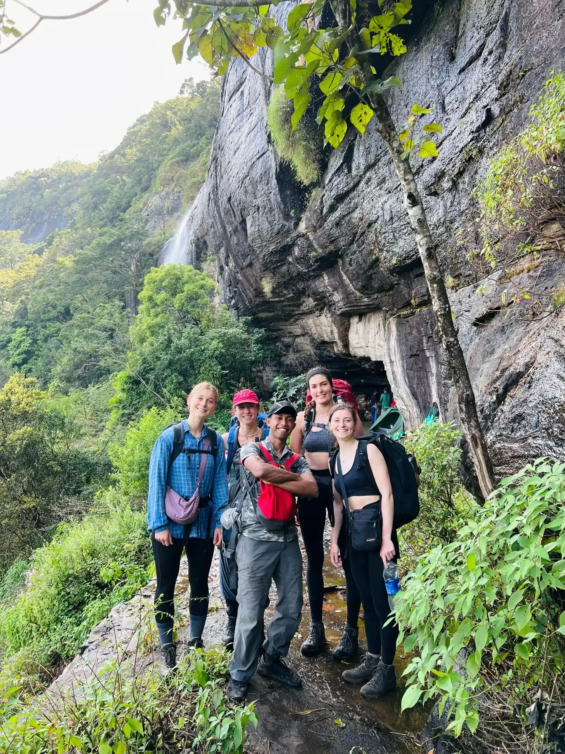
Leaving Thalawakele, this Pekoe Trail stage becomes particularly enchanting, weaving through valleys and connecting small hamlets in a stretch that feels like stepping into a storybook. At 9 kilometres, the trail reaches the St. Clair Tea Factory, which has its own train station. From here, a village track leads to views of St. Clair’s Falls, also known as the “Little Niagara of Sri Lanka” and one of the country’s widest and most stunning waterfalls.
Shortly after, the trail zigzags upward through manicured tea hills with magnificent views of the Kotmale Valley below and the contours of the Nanu Oya River in the distance. At 12 kilometres, a small village in the Derryclaire Estate marks the beginning of the final section, which passes through a shaded forest before joining the Talawakele-Hatton road at Kotagala.
Highlights
- Walk along a scenic dyke between two highland lakes
- A magnificent banyan tree and stream at 1.3 kilometres
- Classic tea trail walking through the Holyrood Estate
- Enter Thalawakele, the centre of Sri Lanka’s largest tea-growing area
- Views of St. Clair’s Falls, the “Little Niagara of Sri Lanka”
- Panoramic views of the Kotmale Valley and Nanu Oya River
8. Pekoe Trail Stage 7: Kotagala to Norwood
Distance: 16.48 km Duration: 5 hours Difficulty: Moderate Elevation Gain: 513 m Elevation Loss: 614 m Maximum Elevation: 1,384 m Region: Hatton People Interactions: High
This Pekoe Trail stage begins in Kotagala, deep in Sri Lanka’s tea country, and winds through colonial-era tea factories, a beautiful highland lake, and rolling tea hills before arriving in Norwood. The first glimpses of the Castlereagh Reservoir appear on this Pekoe Trail stage, offering a preview of the grand scenery that defines the stages ahead.
From Kotagala Through the Estates
This Pekoe Trail stage begins at the vividly painted Hindu Kovil in Kotagala, a prominent landmark that is hard to miss. The trail veers left along a road skirting the outskirts of town and enters the Drayton Estate, passing by the old tea factory and immersing you in the region’s rich tea heritage from the very start.
At 2.3 kilometres, the trail reaches Chrysler’s Farm Tea Factory, a colonial-era factory built in 1870. Its bright blue roof contrasts sharply against the surrounding green tea bushes, making it one of the most visually striking landmarks on this Pekoe Trail stage. Shortly after, the trail crosses a small bridge and the roads widen for an easier kilometre of walking. At 3.3 kilometres, the trail crosses the train line and begins ascending toward the day’s highest section.
Singamalai Lake and Views of Hatton
At 4.7 kilometres, the hilltop of this Pekoe Trail stage reveals stunning views of Hatton town below. At 5.9 kilometres, the trail crosses the train line again, turns near a tea shed, and traverses a small creek leading into tea fields. By 6.3 kilometres, Singamalai Lake comes into view. This small lake provides all the drinking water for Hatton and the surrounding villages and makes for an excellent picnic spot and a well-earned rest on this Pekoe Trail stage.
Into the Bogawantalawa Valley
The following 5 kilometres of this Pekoe Trail stage wind through rolling green tea hills, gradually revealing the first glimpses of the Castlereagh Reservoir in the Bogawantalawa Valley, known as the “golden bowl” of Sri Lanka’s finest tea. At 7.8 kilometres, a football ground to the left reflects the popularity of the sport among tea estate communities.
At 9 kilometres, the Battalgalla Tea Factory comes into view alongside the red roof of the Dickoya and Maskeliya Cricket Club, known as The Darrawella Club and regarded as one of Sri Lanka’s premier planters’ clubs. At 9.4 kilometres, the trail briefly merges with the Agarapatana-Dick Oya road before crossing the Dick Oya River and ascending through a small hamlet.
The Final Descent into Norwood
This stretch of the Pekoe Trail stage feels elevated and wide-open, traversing the tops and sides of valleys. Christian churches dot the landscape here, reflecting the predominantly Tamil community that practices Christianity and Hinduism across these hills. Brightly coloured line rooms, terraced housing for tea estate workers, line the path with Hindu Kovils and small churches alongside them.
At 12.1 kilometres, the Castlereagh Reservoir comes into full view as the trail descends toward the valley. At the base of the valley lies Norwood, a lively tea town. The bridge at 15 kilometres signals your arrival at the town’s edge, and this Pekoe Trail stage concludes 600 metres further into Norwood.
Highlights
- Pass the colonial-era Chrysler’s Farm Tea Factory, built in 1870
- Views of Hatton town from the hilltop at 4.7 kilometres
- Singamalai Lake, Hatton’s primary drinking water source and a great picnic spot
- First views of the Castlereagh Reservoir in the Bogawantalawa Valley
- Visit The Darrawella Club, one of Sri Lanka’s premier planters’ clubs
- Colourful tea estate communities and line rooms along the valley
9. Tips for Walking the Pekoe Trail Stages
Start Early Every Pekoe Trail stage benefits from an early start. The cooler morning temperatures make the climbing sections far more comfortable, and the early light over the tea estates is genuinely beautiful. A 6.30 am pickup is standard for guided stages.
Wear the Right Footwear Comfortable trail running shoes or lightweight hiking boots work best across all Pekoe Trail stages. Avoid heavy leather boots as they are uncomfortable on the hard-packed estate roads that make up a significant portion of the route.
Carry Enough Water Clean water sources can be scarce between towns on some stages. Always carry enough water for the full distance of each Pekoe Trail stage and refill whenever you have a reliable opportunity.
Prepare for Leeches Leeches are common in the forested sections of the Pekoe Trail Sri Lanka, especially after rain. Leech socks and a tobacco or salt spray are essential items for any forested Pekoe Trail stage. Check your legs regularly at rest stops.
Take a Guide A knowledgeable local guide adds enormous value to every Pekoe Trail stage. The trail can be complex to navigate in places, particularly on Stages 2 and 3. A guide also brings the cultural and natural history of each Pekoe Trail stage to life in a way that no map or guidebook can replicate.
Carry Cash Card payment is rarely available along the Pekoe Trail Sri Lanka outside of the main towns. Carry Sri Lankan rupees for food, drinks, and any supplies you need along the way.
10. Responsible Trekking on the Pekoe Trail
Every Pekoe Trail stage passes through working tea estates and living communities. How you conduct yourself along the route matters a great deal.
Leave No Trace: Carry all rubbish out with you from every Pekoe Trail stage. Do not leave food packaging, water bottles, or any other waste on the trail or in the villages you pass through.
Stay on Marked Paths: The Pekoe Trail Sri Lanka passes through active tea estates. Stay on the designated path, close any gates you open, and never wander off-trail through the fields or estate property.
Support Local Communities: Buy food and drinks from local shops along each Pekoe Trail stage. Stay in community-run guesthouses and homestays where available. These choices keep money in the hands of the people who live and work along the trail.
Respect Wildlife: Keep a safe distance from any animals you encounter. Never feed wildlife. In the forested sections of Stage 3 where larger animals are present, move quietly and follow your guide’s advice closely.
Respect Cultural and Religious Sites: The Pekoe Trail Sri Lanka passes Hindu Kovils, Buddhist temples, churches, and mosques. Dress modestly, speak quietly near places of worship, and always ask before photographing people or religious sites.
Use Reusable Items: Bring a reusable water bottle and avoid single-use plastic packaging on every Pekoe Trail stage. The landscapes you walk through deserve to remain clean and unspoiled for the trekkers who come after you.
11. Frequently Asked Questions
Do I need a permit for each Pekoe Trail stage? Yes. An official Pekoe Trail Pass is required for all stages and can be obtained through the official Pekoe Trail website or app. Some stages passing through protected areas may carry additional entry fees.
Can I walk just one or two Pekoe Trail stages? Absolutely. Every Pekoe Trail stage can be walked individually as a day hike. You do not need to walk the full trail to have a meaningful experience. Many people choose one or two stages that suit their time and fitness level.
Which Pekoe Trail stage is best for beginners? Pekoe Trail Stage 1 (Hanthana to Galaha) is the most beginner-friendly, rated easy with manageable distance and elevation. Stages 4, 5, 6, and 7 are all rated moderate and are also suitable for trekkers with a reasonable level of fitness.
Which Pekoe Trail stage is the most difficult? Pekoe Trail Stage 2 (Galaha to Loolkandura) is rated the most difficult of the first seven stages, with 853 metres of elevation gain and demanding terrain throughout. Pekoe Trail Stage 3 is the longest at 18.11 kilometres and rated difficult.
Is the Pekoe Trail Sri Lanka safe to walk? Yes, the trail is safe when properly planned and walked with a knowledgeable guide. Some stages are remote and the navigation can be complex, so having an experienced guide significantly improves both safety and the overall experience.
How do I get to the start of Pekoe Trail Stage 1? The trail begins at the Ceylon Tea Museum in Hanthana, just outside Kandy. Kandy is well-connected by train and bus from Colombo. You can check train schedules and book tickets through the Sri Lanka Railways official website.
Do I need a visa to visit Sri Lanka? Most international visitors need an Electronic Travel Authorization before arriving. You can apply through the Sri Lanka ETA official portal and should check the latest requirements for your country before travelling.
Lanka Trek has been guiding trekkers through Sri Lanka’s most beautiful trails for over 10 years. We offer professional guides, customised packages, and everything you need to experience every Pekoe Trail stage safely and memorably. Get in touch to start planning your adventure.
Pekoe Trail Stage Guide: First 7 Stages Explained
Pekoe Trail Hikes Near Kandy: The Ultimate Guide